loading
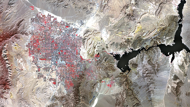
featuresThe big pictureYale geographer Karen Seto uses satellite imagery to find out what urban growth is doing to the planet. Karen Seto, the Frederick C. Hixon Professor of Geography and Urbanization Science at the Yale School of Forestry and Environmental Studies, studies urbanization and its impact on the environment, including climate change. She uses satellite images to study and demonstrate urban growth, especially in rapidly developing places such as China and India. She led the chapter on how cities can mitigate climate change for the fifth climate report of the Intergovernmental Panel on Climate Change, published in 2015, and she is leading the same chapter on the sixth report. She is the coauthor, with research associate Meredith Reba ’14MESc, of City Unseen: New Visions of an Urban Planet, a book of satellite images published in 2018 by Yale University Press. Karen Seto: There are several reasons why we use satellite data. One is that it gives us this bird’s-eye view that you don’t get from the ground. And then there’s the fact that this is a continuous fabric: we can zoom from the individual building scale all the way to the world. This lends itself to understanding spatial patterns that you can’t see when you’re on the ground. Another thing that we can do with all these satellite data is we can see things that our eyes can’t see—hence City Unseen as the title of the book. Our eyes can only see in the visible portions of the electromagnetic spectrum. But if we could see in longer wavelengths, like in the near infrared, or the long wave infrared, you would see the landscape totally differently. We’d see vegetation as really, really bright, because vegetation reflects a lot of energy in the near infrared. S: Yes, the value of satellite imaging is the repeat cycle. Most satellites pass over the same spot every 12 to 16 days. With multiple satellites, we can image the same place every 8 days. So we’re imaging the same place on the planet at a regular interval. 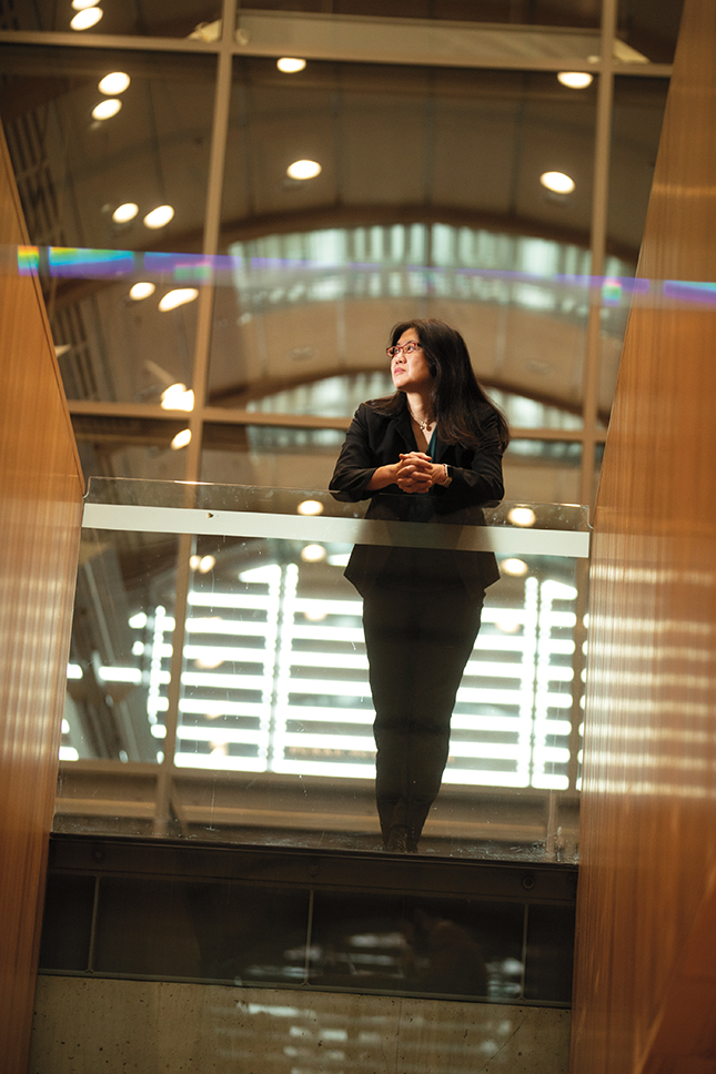 Mark OstowKaren Seto, seen here in Kroon Hall, led a chapter on cities and climate change in the last report of the Intergovernmental Panel on Climate Change. View full imageY: What kinds of things have the data taught you? S: The key thing is we’re able to see how urbanization is changing the face of the planet, literally. We’re in this really remarkable time in human history. People now live in urban areas more than they live in rural areas worldwide. This is new, as of about the last ten years. S: Yes, in Asia and also in Africa. We’ve also done a lot of studies on how urban expansion will affect biodiversity, wildlife habitat, agricultural land. And we’ve looked at urbanization and its impact on carbon. These are all questions you can only answer if you’re looking at this scale. S: Prior to the fifth assessment report of the IPCC, which was published in 2015, the IPCC had never had a stand-alone chapter on how cities can mitigate climate. A number of us made the case that urbanization is a big megatrend of the twenty-first century and that urban areas are the confluence of these sectors. And it offers potential solutions to mitigate climate change that individual sectors—transport, buildings, energy, land—don’t offer. S: Yeah, it’s very different. I ended up coleading the IPCC’s first stand-alone chapter on how spatial planning can mitigate climate change. The other thing that’s important to put in perspective is that urban areas contribute to about 78 percent of greenhouse gas emissions from final energy use—that is, energy used by end users. That presents an enormous opportunity to mitigate climate change through cities. S: That’s right. Mayors and local decision leaders are often very responsive to their constituents, more so than at the national level. They’re more nimble, they’re responding to fewer residents, and they’re responding to less diversity in perspectives than at the national scale. There are hundreds of experiments at the local level that are happening all around the world to mitigate and adapt to climate change. S: One is district energy networks for heating and cooling that utilize waste heat and renewable energy in cities. Some are ideas around mixed land use: providing incentives to enable people to have multiple modes of transportation to get to work. And co-locating homes with jobs. S: Right. You can have mixed-use buildings, but in order to really scale that up to have an impact, you need to have mixed-use regions, mixed-use cities. Most people in the United States don’t live in the same city where they work. It’s about helping to create communities that are more accessible—where you have more co-location of activities: where people live, where they work, where they recreate. S: Yes, they recently outlawed single-family zoning. And California just recently passed something allowing homeowners to build additional units on their lots. But it’s very clear from the science that increasing density alone is insufficient to reduce emissions. We have to have increased population density along with increased employment density, and these two things have to be co-located. Having a bunch of people in one place, all commuting really far away to work, is not going to reduce our emissions. S: Different strategies have to be deployed for places that are already built. We call this “carbon lock-in”: places where there’s already infrastructure in place and behavior that’s locked in. The strategies for these places will be quite different from the strategies and places that have not been built. A car-centered urban [area] is carbon-intensive. But even if we switch to a totally decarbonized society, this form of urbanization still uses a lot of material and takes up a lot of land. S: Yes, it often is. An important part of the story is about the world’s most productive land being taken up by cities. Urbanization in the next 20 or 30 years will continue to be in places that are very productive. This is especially the case in places like Egypt and Vietnam and Pakistan, where it’s forecast that new cities will be precisely where the most fertile agricultural land is now. So we’ve lost a bunch of our fertile agricultural land, and we’re going to continue to lose fertile agricultural land. If we think about the domino effects of this, we’re going to have to convert forests and savannas and other kinds of land. And we’re going to have to pump in a lot of fertilizers and pesticides to make those more productive. Urban dwellers eat more processed foods, more sugars, more dairies, more meats. S: Adaptation to climate change is an important one. Most people worldwide live in urban areas and most of these places are also on the coast, so climate change is going to be a big challenge for a lot of cities. But not just cities on the coast. We’re seeing urban flooding now all around the world. Thousand-year floods are happening every ten years or hundred years. The other really big issue is the interface of urban areas and wild land. These fires that we’re seeing in California would not be such an issue if we didn’t S: The IPCC’s mantra is that we are policy-relevant but not policy-prescriptive. We assess the scientific literature and we basically answer the following questions: how do cities and urban settlements contribute to climate change? What are the strategies and policies that urban areas can deploy to mitigate climate change? Our job is to present all the different solutions. It’s up to the policymaker to say, this is what I choose given my constraints.
The comment period has expired.
|

|
 Print
Print Email
Email